ECOSYSTEM BRIEF
WATCH ON YOUTUBE ↗ TMG Home
 TAK ENABLED · MISSION READY
One ecosystem.
Total awareness.
From edge-deployed TAK servers to AI-powered plugins, cross-platform apps, operational solutions, and offline-ready data—Tech Maven Geospatial connects the entire mission.
SYSTEMS CONNECTEDEDGE → CLOUD → COMMAND35.00° N / 78.00° W
BUILT FOR THE MISSION
DEFENSE PUBLIC SAFETY INCIDENT MANAGEMENT CRITICAL INFRASTRUCTURE
/ WATCH THE ECOSYSTEM
See TAK in action.
Explore the connected ecosystem, then go deeper on tactical AI and local analytics at the edge.
/ ECOSYSTEM OVERVIEW
Every layer of the
operating picture.
Five connected capability areas. One interoperable ecosystem designed to move information from source to decision—without friction.
01
Infrastructure
TAK Servers
Deployable TAK infrastructure from mobile edge nodes to full-scale command operations.
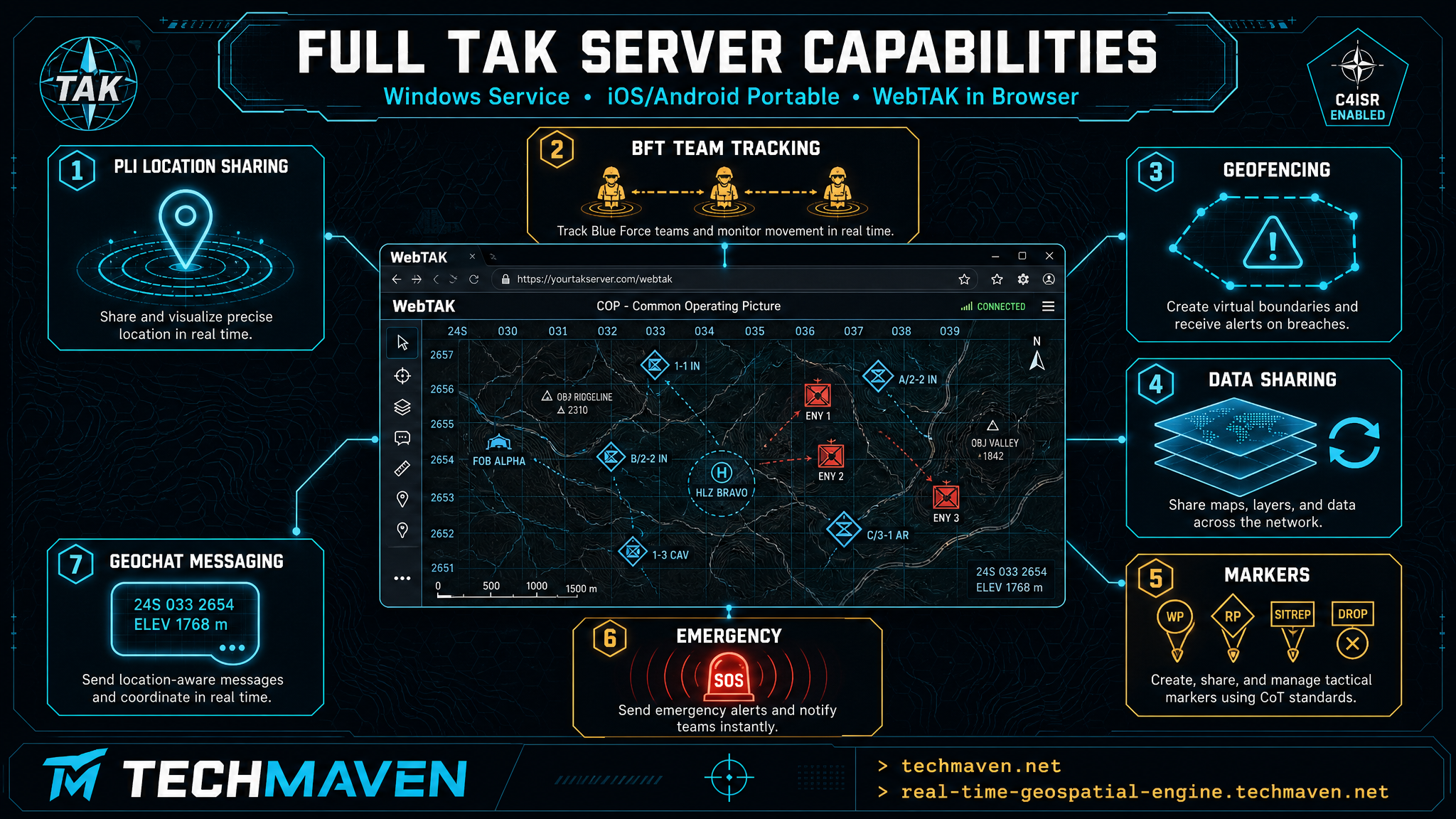
WINDOWS · iOS · ANDROID
Real-Time Geospatial Engine
A real-time data integration engine and TAK Server that connects files, networks, internet sources, and Software Defined Radio.
iOS · ANDROID
Portable Tile Server
A full-featured TAK Server, video server, and AI server built for portable, field-ready deployment.
02
Edge Intelligence
ATAK Plugins
Bring advanced analytics and local intelligence directly into the ATAK mission environment.
03
Mission Applications
TAK Enabled Apps
Purpose-built applications that extend the connected operating picture across platforms and missions.
CROSS-PLATFORM
FieldSentinel
Field operations, team awareness, and connected situational intelligence.
iOS
GeoNames Map Explorer
Discover, search, and work with geographic names and places in the field.
iOS
Geo Data Collector
Collect accurate, structured geospatial data wherever operations happen.
iOS · ANDROID · WINDOWS
Map Explorer
Explore maps and mission data across desktop and mobile platforms.
WINDOWS
3D Map Explorer
High-performance 3D terrain and geospatial visualization for Windows.
DUCKDB EXTENSION
TAK Gateway
A DuckDB extension for bi-directional Cursor on Target communication across TAK-connected systems.
04
Operational Solutions
TAK Enabled Solutions
Complete operational solutions for government, public safety, industry, and critical infrastructure.
INCIDENT MANAGEMENT
GeoSight Ops
A unified incident management and operational awareness solution for industry, government, and public safety.
ELECTRIC UTILITIES
GridState
Connected geospatial operations and grid intelligence for electric utility teams.
ELECTRIC UTILITIES
VoltGrid
Purpose-built situational awareness and operational tools for utility infrastructure.
MARITIME OPERATIONS
Marine Server
Connected maritime awareness and geospatial services for vessels, waterways, and coastal operations.
AVIATION OPERATIONS
Airport Operations
TAK-enabled situational awareness for coordinated airfield, asset, and incident operations.
PORT OPERATIONS
Port Operations
A connected operating picture for port security, logistics, assets, and incident response.
05
Mission-Ready Data
Ready-to-Go TAK Data
Skip the prep. Download field-ready datasets engineered for offline and disconnected TAK operations.
READY FOR YOUR NEXT MISSION
See what the full
ecosystem can do.
Explore Tech Maven Geospatial’s complete portfolio of geospatial products, custom solutions, and professional services.